Orange Quail

I had a customer ask me quite a while back (back far enough I don’t remember who) if I knew anything about a possible Indian scout that may be buried in the Greenwood Cemetery.  I had to admit I did not.  He told me about a stone he found bearing the name Orange Quail.  I took a walk through the cemetery and found the lone marble stone.  If you were to walk through the main gates and keep walking straight through the little building to the far north end of the grave yard, you will find his stone just to your left. This section is designated as ‘U.S. Gov.’ and you will find a number of veteran’s graves there.  The cemetery looks empty in that section, but there is evidence of some missing stones and sunken graves.

This stone shows that Private Quail served in Co. G of the 79th U.S.C.I. which stands for United States Colored Infantry.  During the Civil War when both African Americans and Native Americans enlisted in both Federal and Confederate Armies, no distinction was made between the two; both were considered ‘colored.’  With the name ‘Orange Quail’ I was working under the assumption that our subject is Native American.  I am glad I waited one more week to send this to press, because in that time I was able to confirm (despite the convincingly Indian name) that Orange Quail is in fact an African American.

Thanks to Ian Spurgeon who is presently completing a book on the 1st Kansas Colored Troops I was able to learn more about Orange Quail’s military history.  The 79th Regiment was organized from the 1st Kansas Colored Infantry on December 13th 1864.  In fact Orange Quail first enlisted with the 1st Regiment December 23rd of 1863, which was then stationed at Roseville, Arkansas.  His muster card shows that he was from Ozark, Arkansas.  He was about 20 years old and 5 feet 8 inches tall, described as ‘dark copper’ in complexion and ‘free.’  According to Spurgeon, this makes Quail one of the few (10% or less) who was not a slave at the start of the War, providing his status was not misrepresented.  Orange also enlisted with 18 year old Finn Quail who is believed to be a brother or near relation.

We do have a list of the battles the 79th was engaged in during its service.  They encountered the enemy at Sherwood, Mo. May 18th 1863; Cabin Creek, Cherokee Nation, July 1st and 2nd 1863; Honey Springs, Indian Territory, July 17th 1863; Lawrence, Ks. July 27th 1863; Horse-Head Creek, Ar. February 17th 1864; Roseville Creek, Ar. March 20th 1864; Prairie D’Ann, Ar. April 13th 1864; Poison Springs, Ar. April 18th 1864 where many in the Regiment were massacred; Jenkins’ Ferry, Ar. April 30th 1864; Fort Gibson, Cherokee Nation, September 16th 1864; Timber Creek, Cherokee Nation, November 19th 1864; Joy’s Ford, Ar. January 8th 1865; and Clarksville, Ar. January 18th 1865.

The records show that Quail was hospitalized at Fort Gibson in October of 1864, but whether it was for injury or illness is not known to us.  He was mustered out on the 1st of October, 1865.  We know that Quail was receiving his military pension in 1898, and from the pension form of that year (which someone filled out for him) we find that he could neither read nor write and that he labored for his living.  His wife Mary had died sometime prior; where she is laid to rest I have not learned.   His 18 year old daughter Josaphine was living in Leavenworth at the time.

Thanks to Nancy Carr who found a petition for letters of administration of Orange Quail’s personal property (which amounted to $36) filed on October 3rd of 1903, I was able to narrow down a date of death.  So from there I went to the newspapers and searched for any mention of the death of Quail.

The Council Grove Republican of Friday October the 9th 1903 read, “Dies Suddenly; Orange Quaile an old familiar colored character who is known by almost everyone in Morris County, died suddenly at the farm of Frank Chase’s last Thursday night [October 1st], of heart disease.  He and two other colored men had been employed to cut corn for Mr. Chase and in the evening of his death he ate a very  hearty supper but afterwards later in the evening complained of having a pain in his back, but during the night slept good so his nephew states who was sleeping with him in his sheds, about an hour before he died awakened him but their seemed to be no serious illness with Orange although just before he died he said, I have a little pain, and went to stretch out and died.  Orange was in the war and was a Union soldier and had drawn his pension for a number of years.  He had no family or near relatives and only a nephew at this place.  The remains were buried in Greenwood cemetery.”  Quail was about 60 years of age at his passing.  He is listed on the 1900 census as living in Council Grove but how long he lived here prior to that I have not been able to determine.

What became of Quail’s daughter Josaphine is not known.  It is possible she may have died since no heirs were shown on the administration papers.  W. F. Chapin was the one who filed for letters of administration.  Although I do not know for sure, I would assume that William F. Chapin was the nephew alluded to in the paper.  Letters of administration were never granted, likely because the State of Kansas desired a $75 bond from Chapin.  Quail not owning any significant property probably discouraged Chapin from pursuing the matter.

I admit I was a bit disappointed that I couldn’t prove Orange Quail was our only known Native American Civil War veteran buried in the County.  But, I am satisfied that we have been able to identify another African American who fought for the Union cause, and that the story of Orange Quail has not been altogether lost.

I have found two other men that served in the same Company with Orange Quail; George Thompson, buried in the Abilene Cemetery and Andrew Gregg which I believe is buried at Topeka.

Addenda:  I have been puzzled by the engagement at Lawrence Kansas on July 27 1863.  I have never heard of a battle there on that date and have not had luck finding any source that mentions one.  Quantrill’s raid was about a month later on August 21.  I have found listed in the index of campaigns from A Compendium of the War of the Rebellion by Frederick Dyer published 1908, that the engagement is listed as a ‘skirmish.’  So it would appear that this was not a major battle and went unnoticed in the history books.

William Chapin’s name is found on other documents in County records, so it appears he was probably no relation to Quail, just executing the legal work.

Wilsey

John Derrick Wilsey, town founder. (Courtesy of Morris County Historical Society.)

I must apologize for not getting articles in as regular lately.  It seems that age old conundrum of making a living along with other distractions have prevented me from doing as much research as I would like.  I think some of you will be pleased to know that one of the things that have been occupying my time is putting all of my past articles on a blog.  If you go to fromthebarberschair.wordpress.com you will be able to look up past articles and (where I am able to procure some) I have added photos!  Photos always help.  Now for some more Morris County history.

The Hill Spring post office was established August 21st 1868, Lorenzo M. Hill serving as first post master.  The office was moved to Mildred on December 12th 1878.  The name was changed to Wilsey on May 23rd 1884 and remained in operation until September 27th 1997.  James S. Watkins served as first appointee of both Mildred and Wilsey.

Something interesting concerning the name Mildred is that the name came from the first school which was located at the northwest corner of 1800 Rd. and V Ave.  We don’t know for certain when the structure was built but we do know it was in existence and in use by 1873.  Sometime in the 1880s the old schoolhouse was moved downtown where it served for a number of years as a doctor’s office.  Then after 1950 it was move to the corner of Vorse and Gilmore streets where it served for someone’s home.  Finally it was moved to the lot west of the Christian Church in 1961 where it remains today as a residence.

Mildred school house. (Courtesy of Morris County Historical Society.)

In 1925 A.J. Coffin wrote a brief history of Wilsey for the Centennial.  I hesitate to use him as a reliable source because he states that G.W. Coffin was the first postmaster of Wilsey.  However, as you can see from above, State records do not agree with this claim.  Coffin was the second postmaster of Wilsey, he was appointed less than two months after James Watkins.  J. D. Wilsey owned the land on which the first buildings in Wilsey were erected in 1884.  J.D. was originally from Bloomville, Ohio.  According to A. J. Coffin’s history the first store was built by C. R. Francis.  A Quaker by the name of A.W. Hampton built the second and the third was built by G.W. Coffin, of Coffin Insurance.

Businesses in 1925 were A.J. Coffin, barber; Otis & Mowery Lumber Co.; Wilsey Café; Campbell Theatre &Café; Brown’s Variety Store; Baum & Son Garage; A.R. Sisson Garage; Wilsey Oil Co.; R.W. Powers Drugs; F.S. Riegel; Hudson Blacksmith Shop and Bert Fay Hardware.  H. Scott Wilson was president of the Wilsey State Bank and Alex Randle the vice-president.

Floyd Whiteman, currently of Mission Kansas, remembers working at Riegel’s store from 1946 to 1956.  Whiteman recalls that Bert Fay had an envelope prominently displayed near the cash register in his store.  It was postmarked New York, New York and simply addressed ‘B Fay Wilsey.’  Bert would always comment that there must be only one Wilsey in the United States for that letter to have arrived in his mail, and it appears to be so.

The Kansas Cyclopedia of 1912 says Wilsey “has a bank, a weekly newspaper (the Warbler), a flour mill, a grain elevator, a hotel, telegraph and express offices, and a money order postoffice with two rural routes. The population in 1910 was 350. It is the shipping and receiving point for a large agricultural area, and large quantities of grain, live stock and produce are handled every year.”  The population of Wilsey reached its peak in 1907 with 374 inhabitants.  The population in 2011 was 153.

Although Wilsey is one of the younger towns in the county, its history precedes its founding and incorporation.  There were a number of settlers in the area in the 1860s including Jacob Welcher, the ex-slave and Civil War veteran who we have learned about elsewhere.  The Santa Fe Trail also passes just south of the town, in fact a powder flask and a couple of other artifacts found near Wilsey are on display at the Kaw Mission.

Benjamin Majors

In the summer of 1827, 33 year old Benjamin Majors and 24 other men left their homes in Jackson and Lafayette Counties in Missouri, heading for the Rockies in search of silver that James Cockrell had discovered four years before.  Since Cockrell was the reason for this expedition he was elected captain.  Each man was equipped with one horse, a good gun with enough powder and ball for the duration of the trip, a little bedding, and enough food for about a week.  At that time men had no way of carrying enough food to last more than a week or ten days, they depended upon the fat of the land once their stores ran out.

I do not have great details of this trip, and considering the early period the Santa Fe Trail was not as well defined as it would become in later years with heavy traffic, but it appears that these men followed a path very close to the Santa Fe if not altogether on it.  The party reached the Big Bend or Great Bend of the Arkansas River on their southwesterly route and there found plenty of buffalo for meat.  Before long they had reached the Raton Mountains not far from present day Trinidad.

When Cockrell had reached the area where he had been four years prior he had a bit of trouble locating the silver.  After roaming around in the wilderness for several days the rest of the party were getting anxious, doubting if there really was a silver mine.  Finally the men found some rock flecked with metallic looking bits and that was enough to ease their minds and possibly saved Cockrell’s life.  Of course none of the party knew anything about silver; how to extract it, or even what it looked like.  They had imagined they would be able to cut out chunks of the precious metal with their tomahawks and load their saddle bags then hie for home.

After collecting what they thought good ore, they turned back for Missouri.  The journey went tolerably well until they reached a point near present Dodge City, camping on the banks of the Arkansas River.  After eating their supper of buffalo meat the party prepared for bed.  Two men were placed to guard the horses and changed every three hours through the night.  The Indians were known to do mischief and seeing how each man only had one horse it was crucial they kept an eye out.  On this night the Indians managed to sneak up on their bellies until they were between the guards and the horses.  Then they jumped up firing their guns and shaking their buffalo robes with whoops and hollers, running off the horses, which the owners were never to see again.

Some of the Indians began firing on the men once the horses were run off.  The men sprang from their beds on the bank and into the river up to their knees.  Mark Foster did not cease running once he hit the river and managed to make it to the other side.  He fell several times in his course, the bottom being sandy, and each time the Indians whooped all the greater thinking they had hit him.  The Indians eventually gave up their gyrations and went on their way leaving poor Foster on the opposite bank not knowing if the others in his party were murdered or not.  There he spent the night cold, wet and alone.

When the sun arose in the morning, Foster peered through the fog trying to determine if the figures he saw moving were his men or Indians.  He was convinced it was Indians and so went back to the far side of the river.  The others could plainly hear Foster plashing around in the river but they were pretty well disgusted with his performance of the night before and made no effort to communicate with him.   When the fog had lifted and revealed to Foster that his men were all still alive and the Indians gone, he came within 60 yards and called out to Benjamin Majors, asking if they would allow him to come back into camp.  After a brief consultation they said they would.

Foster walked boldly up to the men and said, “I have something to say to you gentlemen.  It is this:  I know you think I have acted the d—d coward, and I do not blame you under the circumstances.  When you all jumped over the bank I thought you were going to run to the other side, and I did not know any better until I had got so far out I was in greater danger to return than to go ahead.  For, as you know, the Indians were sending volleys of bullets and arrows after me, and really thought they had killed me every time I fell.  Now, to end this question, there is one of two things you must do.  The first is that you take your guns and kill me now, or if you do not comply with this, that every one of you agree upon your sacred honor that you will never allude, in any way, or throw up to me the unfortunate occurrences of last night.  Now, gentlemen, mark what I say.  If you do not kill me, but allow me to travel with you to our homes, should one of you ever be so thoughtless or forgetful of the promise you must now make as to throw it up to me, I pledge myself before you all that I will take the life of the man who does it.”  The men of course considered Foster a very brave man and complied with his wishes.

Now that they were left nearly four hundred miles from home with no horses, the hard part came.  Clark Davis was the heaviest man of the bunch, weighing in at 300 pounds.  The men all agreed that he could not walk the distance and carry his gun and ammo like all the men had to.  So, they were just about compelled to leave Davis on the prairie for the wolves to eat.  All the men loved Davis and that, along with the idea of having to tell his family they were obliged to leave him, prevented them from abandoning him.

Davis’ limbs and feet became very sore and raw after a couple days journey and the men were required to detail five or six men with him for protection as he lagged behind.  The main body would travel on and Davis and the others would catch up with camp about three or four hours later.  This kept on until the men were out of the buffalo belt and quickly consumed what meat they had.  Davis’ extra person he carried upon him then proved to be a blessing as he ended up out-walking the rest of the men who were growing increasingly weaker.

Late in that year of 1827 these worn and weary men arrived at the spot where Council Grove now stands.  All the men, save Davis, were upon the point of starvation and it was Davis who, in their opinion, saved all their lives.  He said, “Boys, I will go kill a deer.”  After a while the men heard the report of the gun and as quickly as Davis could reload, another shot was heard.  “Come here, boys! There is meat in plenty”, Davis shouted, and it didn’t take long for the famished to join him.  They drank up all the blood and ate the livers raw and even scraped the marrow out of the bones, then carried what remained with them.  This tided them over for the next 130 miles to their homes and not one man was lost on this perilous trip.

This story comes to us from Alexander Majors, son of Benjamin and celebrated Santa Fe Trail freighter.  Alexander was continuously engaged in the freighting business from 1848 to 1866, much of that time being contracted with the Government supplying forts in the west.

Archaeological Dig at Skiddy

Terra Coons of White City gave me a copy of a handwritten letter that should answer some of our questions concerning the bridge and artifacts found near Skiddy.  The letter is dated June 24th 1965 and is Floyd W. Johnson’s response to someone’s asking for information about the dig.

Floyd says, “In regard to history of Skiddy Bridge my Father J.A. Johnson had the contract.  We camped on the East side of the creek (Clark’s Creek) until the flood of 1903 ran us out.  Stone work was completed.  In Excavating on the East bank on oak tree had to be dug out and under it a Spanish coin and some Bones were found as I remember the tree was about 18 inches in Diameter.  Father called the State Historical Society at Topeka they sent a Mr. Richey up and he Examined the Earth and took the Evidence there.  I was 14 years old at the time just remember the highlights of the day.  The stone work in the bridge contract price $1.90 one dollar & 90 cents per cubit (cubic) yard some difference in price today and then.  Father was Early day Bridge & Building he was known as 3 finger Johnson.”

Further information comes from W.E. Richey’s address to the Kansas State Historical Society on December 1st 1903.  He made numerous references to various archaeological finds throughout central and western Kansas and elsewhere that were associated with Coronado’s march through the Great American Desert.  One item he mentioned is a Spanish sword which was discovered in 1886 in western Kansas near the Santa Fe Trail.  The man who found this sword gave it to Richey in 1901 and then Richey presented it to the State Historical Society in 1923.  For many years this sword was on display in the museum as an artifact from Coronado’s trek.  In the 1980s, sword experts easily determined that it was not of 16th but 18th century manufacture and German at that.  It is now believed that the sword was intended for army use or trade on the Santa Fe.

What concerns us however, is the following that Richey says about the Skiddy excavation.  “Last winter Mr. J.A. Johnson, a bridge contractor, in excavating for the abutment of a bridge on Clark’s creek, a half mile south of Skiddy, at a depth of fifteen feet, unearthed a fireplace, or hearth, of matched stones, nicely fitted together, on a ledge of solid rock. On this fireplace Mr. Johnson and his workmen found ashes, coals, a buffalo bone, a flint knife, and a coin-shaped piece of brass. The flint knife was of a different color from that found cropping out of the hills near, and (had) undoubtedly been brought from a distance. It had, very likely, been used to cut the meat from the buffalo bone. Near the fireplace a spring or vein of water was uncovered. Above the fireplace, six or seven feet under the surface, an oak tree, two feet thick, had grown. The stump was removed in excavating. There is an unmistakable trace of an ancient channel a short distance east of the fireplace, which was, apparently, at one time west of and near this ancient channel. The present channel is west of and near the fireplace. In the depression where the ancient channel was many large trees have grown. Everything shows that this fireplace was used a long time ago. Another fireplace has since been unearthed in the same vicinity.”

Trails in Morris County

There are a number of old trails that cross Morris County.  Some we are familiar with and others we know very little about.  I would like to take some time for us to learn a little more about these various trails and what they were used for.

The first trail I’ll mention is the Santa Fe as it appears to be the first major trail.  It is very accurately mapped and we know a good deal about it, so I won’t go into much detail on it.  In the early 19th century a number of adventuresome individuals were trying to find a good route to Santa Fe in order to establish trade with the south and west.  William Alexander Becknell was fortunate enough to be the first to arrive in Santa Fe with his men in November of 1821.  He has ever since been known as the father of the Santa Fe Trail.

Becknell had not had very good luck up till this point.  Around 1818 he had bought the Boone family’s salt works near Arrow Rock Missouri.  In 1820 he ran for the Missouri legislature and borrowed money to do so.  He was unsuccessful and the panic from the previous year had already taken a huge toll on his pocket book.  Owing his creditors more than $1,200 he was thrown in jail until a friend bailed him out.  So, you can imagine the troubles that weighed on Becknell’s mind as he headed out across the godforsaken prairie.  Failure was not an option, he had to come home with something.  And he did!  The people in Santa Fe paid handsomely for his merchandise, and he returned to the States with his saddle bags loaded with silver.

One thing I would like for us to consider is the fact that not everyone who traveled the Santa Fe Trail was necessarily going to Santa Fe.  Like many of our highways today, such as 56 and 77 south of Herington, many of the old trails intersected and even converged.  Some travelers on the Santa Fe Trail were going down to Chihuahua in Mexico to trade.  Some were going on to southern California by way of the Gila Trail.  Others might find their way to California by taking the Old Spanish Trail which led up through Colorado and Utah by various routes.   Although the Mormon Trail ran through Nebraska and followed the Oregon and Old California Trails, in the 1840s Mormon immigrants would be using the Santa Fe Trail.   We know that in August of 1846 the Mormon Battalion passed through Council Grove taking the Santa Fe Trail on their way south during the Mexican-American War.  John Maloy states that during the year of 1860 an average of 50 wagons per day were passing through Council Grove on their way to Pike’s Peak.  Also, we cannot claim the only Santa Fe Trail.  There was a lower route, known as the Fort Smith route, which passed from Fort Smith Arkansas through Oklahoma to Santa Fe.

The Kaw Trail is the next oldest trail in the County.  It was put into use about the time the Kaw were moved to the reservation in Morris County in 1847.  The treaty signed with the Osage in 1825 in Council Grove, made the Santa Fe a right-of-way for the white man and the Indians were not suppose to utilize it.  Because of this, the Kaw Trail ran about a mile south of the Santa Fe Trail but nearly paralleling it.  It started at Big John Creek south of Council Grove on the Kaw reserve.  It passes through the counties of Morris, Chase and Marion where Florence now stands and continued on west to Turkey Creek where it intersected the Santa Fe Trail.  Some remnants of this trail can be seen near Diamond Springs, and Florence.  The trail was used by the Kaw going and returning on their annual buffalo hunts out west.  John Maloy, in his History of Morris County, gives a description of the Kaw returning from one of these hunts.  In April of 1869 “the Kaw Indians returned from their winter’s hunt on the plains, looking gaudy and feeling gay.  They had plenty of robes, and their accustomed business of pony stealing had proved both successful and lucrative.  They were met by those who staid (sic) at home with an ovation and the biggest thief, according to custom was permitted to wear a pair of polished horns.”

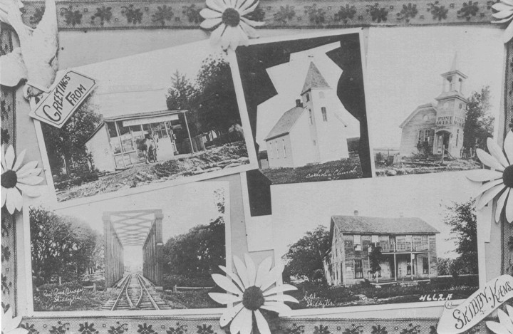
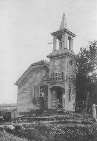
The next trail we have of significance goes by a few different names; the Ft. Scott & Ft. Riley Road*, the National Historic Military Trail or the Government Trail.  We may with reason date the beginning of this trail with the birth of Ft. Riley in 1852-53.  This trail leads from Ft. Riley and passes near Skiddy, White City, Kelso through Council Grove and on southeast to Ft. Scott.  There were two branches of this trail.  The previous mentioned which followed the Santa Fe Trail for a short distance west of town and the second which takes a more northerly route out of of Council Grove.  It is possible that goods were hauled from Ft. Riley to Council Grove by this road.  We know that in April of 1854 the 79 ton stern-wheeler Excel made her first run on the Kansas River from Weston Missouri to Ft. Riley.  She was carrying 1,100 barrels of flour.  More steamboats were employed until trade on the Kansas River finally came to an end along with trade on the Santa Fe Trail in 1866.

There is a trail shown on an 1856 map in my possession that enters Council Grove from the northeast.  I have not been able to determine the name of this trail.  It passed from Uniontown through or near present Alma to Council Grove.  To the best of my ability, I have determined that Uniontown was south of the Kansas River on Vassar Creek approximately 2 miles west of present Valencia.  Also on this map, is a road that at one time passed through the northeast corner of Morris County.  It begins at 110 mile station, simply marked ‘110’ on the map, also on the Santa Fe Road.  From there it heads west and slightly north a few miles from Council City, now Burlingame.  The trail passes a little south of present Eskridge then runs west until approximately the present Morris/Wabaunsee County border just a little south of Alta Vista.  From there it starts veering north and eventually converges with the Ft. Riley Road.  Since the county boundaries have changed in the northeast corner, we have lost most of this old road.  The Kansas Cyclopedia of 1912 identifies this road as one of the many lesser branches of the Mormon Trail.

One of the trails we know least about, and I know so little about it I’m almost embarrassed to mention it, is the Shawnee Cattle Trail.  This trail was brought to our attention a couple of years ago when a man who was very knowledgeable on the subject came to the Historical Society to research it.  He seemed certain that the trail passed through Morris County, and I have found two generic maps of Kansas that show a lesser branch of the Shawnee Trail passing through the area that Morris County would occupy on the map.  This was a north-south trail that went down through Texas to Dallas and Waco.  We do know that some time in the 1870s Council Grove passed an ordinance to prevent cattle drives from coming through the city.  We can safely assume from this that the trail did not come through Council Grove.  A map of historic trails provided by the Kansas Department of Transportation, shows Cottonwood Falls as a trail head for the Texas Cattle Trail.  Again, I don’t pretend to know much about the Shawnee Trail, but with the Texas Trail so close to us, it makes sense that the Shawnee Trail passed through here and may well have joined with this Texas Trail.

*Actually appears as Council Grove Ft. Riley Road on the 1856 map, I have also seen another map of the same year by the same maker but the road appears as C Grove Ft. Riley Road.  I question how accurate the map is as many of the towns and stream names are no longer the same, and in fact it shows Big John and Little John near Council Grove reversed.

I have a little more information to include about our local trails thanks to Larry Timm who has loaned me some maps he’s acquired during his research on the Military Trail.  There are a number of different maps that show trails and roads criss-crossing our County.  Depending on which map you look at you might find the same road running in what seem two different routes.  I have found some mistakes on some maps such as stream names and locations, or as in the case of an 1861 survey map the Kaw Mission appears on the east bank of the Neosho rather than the west.  For the most part I believe these maps are pretty accurate in showing where the road runs.  One explanation for alternate routes is, as Larry Timm put it, “fair weather route.”  When the bottom fell out of the road an alternate route was taken.

We know that the Santa Fe Trail has a ‘high route’ and a ‘low route’ west of Council Grove.  The low route follows along Elm Creek to Helmick.  The high route lies about halfway between town and the City Lake then gradually heads southwest until it joins the Elm Creek route about a mile west of Helmick.  There are also two different routes to the town site of Diamond Springs.  One leads from the intersection of the two Santa Fe routes just mentioned, down to Diamond Springs and on to Marion Center form there.  The second called the Diamond Creek Road shown on an 1870 map, branches off the Cottonwood Falls Road at 4 Mile Creek south of the Grove and follows that creek south and west.

The road I mentioned last week that comes into Council Grove from the northeast and looks like it passed near or through Alma, I have confirmed to be the Council Grove Alma Road and actually shares the course of the Topeka and Duffield roads for a number of miles.

George Duffield came through Morris County in 1866 driving a herd of cattle to Iowa.  He came up through Indian Territory and on the 17th of August struck the Santa Fe Trail 5 miles west of Lost Springs.  The 18th found him camped at the Six Mile Creek Ranch.  He traveled 6 miles to Diamond Springs then 8 more to Elm Creek on the 19th and by the 20th had reached Council Grove and camped east of the Neosho.  His trail north begins approximately one mile east of town.  This is the cattle trail I mentioned last week as the Shawnee Trail (some maps show it as such).  On a U.S. Geological map it is labeled as the Topeka and Council Grove Road as it leaves the Santa Fe, taking a sharp turn east about six miles north of town, basically following the route of Old Highway 4.  The cattle trail branches off from this road and continues north and is labeled the Duffield Texas/Iowa Cattle Drive 1866.  This was supposed to be the longest cattle drive in history and was the inspiration for the TV series Rawhide.  Head ‘em up, move ‘em out!

Duffield kept a diary of his drive.  I have not had a chance to read this diary but I suppose we might be able to connect his drive with the following incident that John Maloy relates.  “In August (1866) a Mexican herder was shot dead by a Texan.  The latter ordered the former to go to camp, the Mexican refused to go, when the Texan drew a revolver and shot him dead in front of the old Hays building.”  A question that comes to my mind is where did they bury the departed?  Did they carry him back to camp and bury him east of town somewhere?  Or did he end up in one of the many unmarked graves in Greenwood Cemetery? What about the Texan who shot him?  Was he contained in Council Grove and tried, convicted, hung?  Or did he go scot free? We may never know.

The Council Grove Cottonwood Falls Road and the Americus Road were both in use by the time the 1861 survey map was drafted.  The former very closely followed the route of highway 177; the latter followed the route of the old Katy Railway.

A road of great interest to me is one shown on the 1870 map of Kansas Indian Lands; the Rock Creek Road.  Only about two and a half miles of it are in our County’s border, but the thing that interests me is where it joins the Santa Fe Trail at the first Agnes City site.  If you don’t remember, that is about a mile north of highway 56 east of Council Grove just before the Lyon County line.  Knowing that two roads met at Agnes City gives us a better idea of the importance of the place and the amount of activity that must have occurred there.  The road continues north following the creek and joins the Alma Road about where Chalk Mound is in Wabaunsee County.

Upon comparing these old trails and roads with a modern map, you will find, as I have already stated, that they nearly follow our present streams, highways and railroads.  The reason for this is it’s hard to improve upon perfection.  The old roads were established where they were because it was easy traveling.  Few hills to go up and down, few streams to cross and good solid ground that you weren’t likely to sink in when it got muddy.  When the railroads came along they went ahead and followed these routes as they were ideal for the rail’s needs.  There is one old road however, other than the Santa Fe, that did not follow the rules and it just cuts out across the country with no rhyme or reason, other than its final destination.  That is the Salina Road, which we know was in use by 1869.  It headed northwest out of Council Grove and cut through the southwest extremity of the City Lake.  It passed about a mile north of the Delevan Airbase and within a mile south of Latimer.  From Latimer it climbs slightly north then heads southwest until it leaves the County approximately a mile north of highway 4.

Benny King told me that he knew an old man who, when a young man, drove a couple of old ladies to Junction City.  This would have been in the nineteen-teens and there was no paved highway at that time.  They just headed out across the country in the general direction to get there.  It is possible that this man may have driven on or crossed some of these old trails on his way to Junction.

Another trail shown on the U.S. Geological Survey map shows an old trail from Ft. Riley forking off from the one we are familiar with at Skiddy and heading west a bit.  It passes west of present Latimer and eventually joins the Santa Fe Trail in the extreme southwestern corner of the County. It is identified as having been in use in 1854.  It also shows a branch forking off of this old road south of Latimer, passing about two miles west of Delevan and then joining the Santa Fe at Six Mile Creek.

Well, I think it’s fair to say that you now know about as much as I do on the subject of trails in Morris County!

I can’t post maps because the ones I have are too big to scan and would be too small to see on this site, or some that I have are poor copies.  You may follow the links below to check out some of the old maps of Morris County.

1870 map of Kansas Indian Lands.  http://specialcollections.wichita.edu/collections/maps/detailsframes.asp?var=1870-0006

KDOT map of historic trails.  http://www.legendsofkansas.com/trails.html

1863 Kansas & Nebraska map.  http://www.kansasmemory.org/item/211766

1856 map of Eastern Kansas.  http://blogs.spencerart.ku.edu/map-of-eastern-kansas-1856/


White City

In 1869 a Rev. Peirce organized a colony in Chicago with the intent to settle in some of the Western States.  J.B. Somers of Council Grove, who was a real estate agent, had been corresponding with Rev. Peirce during the organization of the colony.  About the time the colony was ready to head west Mr. Somers made a trip to Chicago to finalize some things and accompany the group of some 40 families to Morris County.  This Somers was the same that married Judge Baker’s widow and later drowned in the Neosho River.

The first location of this settlement was about three miles north and west of Parkerville on the MKT railway.  Not too long afterwards the colony moved two miles further up the track and settled on land owned by T.S. and W.J. Mackenzie.  The Mackenzies were instrumental in the organization of this settlement and in 1871 had the town site surveyed.

An interesting story in the White City’s Centennial Times of August 22nd 1985, is about a passenger train that came through in May of 1871.  It was promoted as an ‘Investors Special’, and carried a bunch of New Yorkers who had come to take a gander at the Kansas prairie.  A group of Kaw Indians overran the train and brought it to a stop between White City and Council Grove.  “The train was decorated with U.S. flags.  It was reported that as soon as the train stopped, the Indians swarmed over it, stole all the flags and tried to get in the coaches, which were quickly locked.  No one was injured and the train proceeded on to Junction City, with some of the Indians chasing the train on ponies.”  This of course was fabricated completely for the entertainment of the easterners.

The town was first called Swedeland or New Swedeland, however, the post office established on January 2nd 1872 was called White City.  It appears on an 1878 map of Morris County as Swedeland and on the 1887 map as White City.  I think it is reasonable to say the name was officially made White City when the town was incorporated as a third class city on October 17th of 1885.  A story passed down by the locals says that the Rev. Peirce was the one who pushed to have the town located at the site closer to Parkerville and that he wanted it named New Chicago.

Thomas B. Eldridge was the first to build a house on the town site and that would probably explain why he was the first postmaster appointed to the White City post office.  For those of you who know your antebellum history, the name Eldridge should ring a bell.  Thomas was a brother of Colonel Shalor Winchell Eldridge of the famed and fated Eldridge Hotel in Lawrence.  Thomas also built the first hotel in White City which was later managed by railroad superintendant Francis C. White.  This F.C. White was so highly favored the town was named after him, so goes the local history.   The limestone post office and the hotel still stand in White City at the intersection of McKenzie and Commercial Streets.  The hotel has been divided into two separate houses, both sections remaining in the same block.

House built by Thomas Eldridge in 1871. Commonly called the Commercial House or the Jenson House. The 1902 rear addition was torn down in the summer of 2013. (Courtesy of White City Library.)

James Thornley and W.N. Dunbar built the first store in 1872 and the following year a schoolhouse was erected.

By 1883 White City had grown to about 200 and boasted three general stores, one grocer, millinery, drug store, two wagon shops and two elevators.  There was a Methodist and Congregational church at that time as well.

In 1887 the Chicago, Kansas & Nebraska Railway laid track from Topeka through White City.  By 1891 it was taken over by the Chicago, Rock Island & Pacific Railway.  In 1980 that line became the Oklahoma, Kansas & Texas Railroad and then merged with the Missouri Pacific in 1988 which then merged with the Union Pacific in 1997.

I recently made a trip to White City where Terra Coons gave me a special tour of the box car museum at the Katy Park and the Baxter school house.  In front of the box car is a very hefty limestone block that was once part of a bridge near Skiddy.  The block is engraved ‘Quivira of Coronado 1541 Identified By W.E. Richey 1880-1903’. Apparently this Richey believed that the artifacts uncovered at the excavation for the bridge were none other than Coronado’s and so the site was marked with the construction of the new bridge.

The box car has been restored and now houses a plethora of local artifacts.  One room of the car is filled with hand tools from the Frank and Waunita Folsom collection.  There are a number of excellent photographs of White City’s olden days.  One photo that caught my attention was the all women’s brass band.  There was no date on the photo but by the dress we guessed it shortly before or at the turn of the century.

The Katy Park also has a very nice monument honoring the veterans of White City.  The town has made an excellent endeavor at preserving its history and making a neat and attractive display for visitors.  Like most towns, White City has had its share of destructive fires taking out a good many of the old buildings.  Individuals in the community have made great efforts in preserving the remaining old buildings.  Nina Miley restored an old limestone building that otherwise would have become a pile of rubble.  It now serves as her law office and B&B.  Many other buildings are in good repair and neatly cared for.

The old Jenkins Brothers building restored by Nina Miley. (Courtesy of White City Library.)

We also looked at the Baxter school house located just north of the Katy Park.  The school house was originally located 8 miles west of White City on June Baxter’s property.  Baxter came to the county in 1858.  His wife Elizabeth was the first teacher and before the school house was built, class was conducted in the Baxter home.  The school is in fine repair and used for community activities.  A demonstration was given to the public as to how class was conducted in the old days, with children participating and experiencing first hand.  A clogging demonstration is planned to be held there later this spring.  We hope to remain informed on upcoming events.

One annual event I always look forward to in White City is the St. Patrick’s Day supper at the Christian church.  For the past several years Charlie Laughridge and I have entertained the diners with some Irish fiddling.   And of course we are rewarded with a generous slice of corned beef and cabbage with a baked potato.

White City’s population in 1910 was 506, and by 1920 the population reached its peak at 652.  The 2010 census shows a population of 618.  Unlike other towns in the county, White City has not only shown an increase in population over the past decade, but over the past 30 years.  It has surprisingly maintained a pretty steady population over the past one hundred years. What could the rest of us learn from White City?

Parkerville

Charles G. Parker, founder of Parkerville. (Courtesy of Bob Strom.)

It was brought to my attention that I had neglected to mention Parkerville as the only town in the Nation with that name.  I knew I’d forgotten someone when I was making that list!  I’ll admit I have intentionally been avoiding Parkerville. Not because I don’t like it.  I’m actually quite fond of Parkerville.  I considered buying property there once.  My great, great granduncle Richard Varner’s house and his son’s house are still standing in Parkerville.  My great grandfather and his sister were born and went to school there.  I have a bond that connects me to the little town across the generations.  The reason I’ve been silent about Parkerville is because local historian Bob Strom has said about all there is to say concerning Parkerville.  I feel there is nothing more or new I can add to the annals.

It may be accurate to say that the town was first named Parkersville, as that was the name of the post office established there August 9th 1870.  The first postmaster of that office was Charles G. Parker for whom the town is named.  Charley’s monument in the Parkerville Cemetery says he was born May 5th 1821 and died September 7th 1909.  His obituary in the Council Grove Guard of September 17th 1909 says he was born in 1820 and died at the age of 89 years, 4 months and 2 days.  Whichever birth date you choose to observe doesn’t change the fact that C.G. Parker was quite old when he died.

Parker first passed through Kansas in 1849 on his way to New Mexico.  He was engaged in trading on the Santa Fe Trail for nearly 20 years. The Council Grove Press of August 25th 1860 reads, “C.G. Parker’s train consisting of 21 wagons, 225 mules, and 30 men passed through Wednesday.  He had come from Las Vegas, New Mexico and was going to Kansas City.  Mr. Parker’s wagons were loaded with government stores.  He also brought 18 passengers from New Mexico to the States.”  The passing of many years didn’t seem to slow this old freighter down much.  Just a few years prior to his death he had taken a shipment of cattle by train from Parkerville to Kansas City.

Of course, no history of Parkerville would be complete without the story of the Great County Seat Contest of 1871.  The town was incorporated in February of that year and was the only town other than Council Grove that was incorporated.  I suppose that gave Parkerville a legitimate reason to vie for county seat.  Most will be familiar with the basic story that Council Grove built a nice stone wall around the cemetery and Parkerville made a beautiful city park in the town square, both for the sake of keeping workers around to swell the vote in their favor.  This may or may not be true, but I’ll share what I have found and you may decide for yourself.

The 1912 Kansas Cyclopedia simply states that Parkerville ‘began a spirited contest to become the county seat.’  Cutler’s History of the State of Kansas of 1883 says, “It once had pretensions to be the seat of justice and disputed the field with Council Grove for this honor. Having been defeated it resumed the tenor of its way, and the people turned their attention to making the town as attractive as possible and to compete for the trade of the surrounding country.”   Neither mentions employing shady means to obtain the end.  Council Grove did install street lamps the year of the race, and the Odd Fellows built the stone wall around the cemetery.  There are a number of accounts here and there that mention as many drovers as bovine on the prairie at the time of the election and there were nearly as many ballots cast as there were man, woman and child in the county.  Never since has Morris County had so many turn out to vote.  After the election was over a petition was circulated in an attempt to put it to a vote again, but it failed and the City of Council Grove voted on the issuance of bonds to start building a court house.

The first newspaper in Parkerville was the Morris County Enterprise, first printed January 3rd 1878.  Like most papers in their early days, it changed partners and hands a few times and finally died.  The last issue we know of was printed on September 19th 1884.  Parkerville went without a paper until October 8th of 1887 when the first issue of The Parkerville Times left the press.  It had a very short run and keeled over on July 14th the following year.

One item from the first issue of the Parkerville Times, although not strictly Parkerville related, I thought of interest.  There’s an advertisement for S.H. Barrett’s circus that came to Council Grove on Tuesday October 11th of 1887.  Incidentally, it also passed through my hometown of Quenemo.  Among the many wonders in the side show was Jo-Jo the dog-faced Russian boy.  Fyodor Yevtishchev was born in 1868 and had a rare condition called hypertrichosis, also known as ‘werewolf syndrome.’  Basically it caused him to have an unusually abundant growth of hair on his body and face.  His father suffered from the same and had toured France in the circus.  The great P.T. Barnum discovered Fyodor and brought him to America in 1884 at the age of 16.  Barnum concocted the story that his human Skye Terrier and his father were tracked to their cave in Kostroma and were savages. Fyodor was far from a savage though; he could speak German, Russian and English.  He died of pneumonia January 31st 1904.

Well, back to the newspapers.  The next paper to come to town was the Parkerville Tribune, first printed January 16th of 1896.  By January 7th of 1898 the paper came under the ownership of T.B. Haslam of Council Grove and the month following he changed the name to The Morris County News.  August 31st of 1900, the last paper was printed in Parkerville and White City took over the responsibility of furnishing Parkerville with news.

From Cutler’s History of the State of Kansas of 1883 we read, that Parkersville (sic) “is a very neat little burgh and a good deal of taste is exhibited by the manner in which the houses and their surroundings are kept.”  At that time Parkerville had one store that sold dry goods and groceries, two drug and groceries, one hardware and groceries and one solely groceries.  If any assumptions could be had about the folks in Parkerville, they ought to have been well fed.  They also touted two cheese factories, two harness and one wagon shop, and the steam grist and saw mill that was built by Charles Parker in 1871.

During the 1925 Centennial celebration in Morris County, a program was printed highlighting all the towns.  Along with a short history of the towns were listed the current businesses that sponsored the Centennial.  We get a little look at what merchants there were in Parkerville in 1925.  Burgner, Bowman & Matthews Lumber Co. of Council Grove (located where Schwerdtfeger Auto Sales is presently) had a branch in Burdick and one in Parkerville of which Lee Churchman was the manager.  The Parkerville Garage was operated by George Stewart; Mr. & Mrs. Charles Roehrman owned the Café; A.G. Ernst was the proprietor of Wear-u-Well Shoes; Arnold Roehrman was the barber; W.D. Winters the postmaster and S.L. Cannon ran the General Merchandise.  The Peoples State Bank, which was organized in 1909, boasted a capital and surplus of $11,500.  W.H. Dodderidge and William Churchman were president and vice-president respectively.  A.G. Porter served as cashier and H.W. Clayton the assistant cashier.

Even though it appears the locals called the town Parkerville early on, it was not until June 23rd 1892 that the name of the post office was changed and the ‘s’ dropped from Parkersville.  Mrs. Emma J. Hall was appointed the new post mistress.  The post office remained open until October 31st 1953.  Parkerville may not be what it once was, but then again is any town?  One thing that remains in the hearts of the few that remain there is pride for their community, and it is reflected in their work to maintain the park, the band stand, the church and the few remaining old buildings.

Circa 1870 tintype. Left to right, front (first three unknown); Clara Poole Varner (the author’s great-great grandmother); unknown; Fanny Baker Churchman; Pet Rinard; Aunt Vic Rinard Morris; Jake Morris with son (on chair); Joe Varner (on fence); Mary Rinard Burton (middle girl on stairs); (above) Vic Kingsbury; Louie Baker Ramsey; Birdie Rinard Barber; Della Varner Glasscock; unknown; Ham Rinard. Currently the home of Pete Mackenzie. (Courtesy of Morris County Historical Society.)

The Cottage House

            In 1867, George Biglin built a three room cottage and blacksmith shop at 25 north Neosho in Council Grove.  In 1871, Reverend Joab Spencer bought the property and built a two story house around the cottage and began taking in boarders.  This house is referred to as an Italianate ‘cube’ in the National Register of Historic Places Registration Form, and is supposed to be the southeast section of the Cottage House Hotel.  The Spencers sold the property to Mr. and Mrs. Lewis Mead in 1879.  Mead was partner with McCollom in a hardware and grocery business, you may remember their building burned in the 1886 fire.  Mead helped organize the Morris County State Bank in 1878 and became president as well.  His first wife Sarah died in 1886, and it was his second wife, Sarah’s sister Josephine, who made the hotel the pinnacle of luxury and comfort.  In fact, Aunt Jo’s gift parlor is named after the illustrious Josephine Mead.

In an interview with Connie Essington I learned that the Meads were entertainers.  Mrs. Mead was known for her delectable dishes.  They served the best food on the best China, and everything in the table arrangement was to be nothing short of perfection and elegance.  In 1898 the Meads had a 5000 square foot addition built.  This gave the Cottage House the look we recognize today; a brick, two story semi-circular front with corbelled parapet and the distinctive front porch with gazebos.

It was at this same time the Honeymoon Cottages directly south of the main hotel were built.  Originally these rooms were known as the Sample Rooms.  Traveling salesmen displayed their wares in the Sample Room and when a customer was ready to make a purchase they would use the Writing Room (in the north lobby of the main building) to fill out the paperwork.

An article in the Kansas City Star of February 12th 1911 gives a visitor’s description of the hotel.  It emphasized that the Cottage House was unlike any other hotel in that when a person entered they felt as though they were at home.  It didn’t look or feel like other hotels, it wasn’t musty and dirty with old worn furnishings.  Instead, there were expensive carpets and richly upholstered chairs and rockers, a big leather couch and a large library table.  The lobby was kept neat and clean like the parlor of anyone’s home.  The bedrooms had high ceilings and were clean, fresh and had every little detail like the guest bedroom of one’s home.   The dining room, besides having several tables, also boasted a china cupboard, sideboard and a “display of dishes around the platerail with which every housewife delights to adorn her dining room.”

In 1913 the northwest addition was made adding 12 rooms to the hotel.  Around the same time a 16’x14’ two story conservatory was added on the south side of the building.  It was said that tropical fruits and flowers were grown there.

Lewis died in 1924 and Josephine followed after in 1932.  In 1934 the Brattons bought the property at the sheriff’s sale and then in 1943 leased the building to the U.S. Government.  Partitions were added to create more rooms for the personnel employed at Delevan Airbase.   When the government turned it over again in 1946 some of the old barracks from the Air Base were moved to the property adding ten more rooms to rent.

In November of 1960, Mayor Harry Rosser, Judge Walter Hembro and Marlin Brown purchased and invested $75,000 in remodeling the building.  In an attempt to modernize and streamline the old hotel they removed the porch and most of the interior doors with transom because they looked too old fashioned.  The brick was painted white, a more modern entry constructed and it was renamed the Stagecoach Motor-Tel.

In September of 1982 the Essingtons bought the property and over the next ten years brought the Cottage House back to its former glory.  They reclaimed the old name, replaced the porches, and did extensive interior renovation.  The Essingtons continued to operate the Cottage House until February of 2010 when Jeremiah and Dawn Hershberger became the proprietors.

In 1996 the two story house at 28 N. Mission Street was purchased and became the Cottage House Annex.  Historically it is known as the Stenger/Blim house and was built by Jacob Stenger in 1863.  It originally stood at 220 W Main where the Farm Bureau building is currently.  In 1914, H.E. Blim moved the house to its present location where the west wing and porch were added.  The house was sold and became a private home a few years ago.

Of the many fond memories that stood out for Mrs. Essington was an occasion when Doran Welton Barham and his wife stayed at the Cottage House.  Barham was an architect as well as artist and painter.  He received his degree at Kansas State in 1950 and afterwards went to work for Thomas & Harris, an architectural firm in Wichita.  It was probably during this time that he drew several old and beautiful homes that were going to be torn down to make room for the hospital.  By chance, Mrs. Essington purchased this artwork at a sale and it found a new home in the hotel.   Mr. Barham saw his work on the wall in the hotel and said “oh my!”  He then related to Mrs. Essington that he was the artist that had drawn it many years before.

Addenda:

Concerning the restoration project on the Cottage House, Connie Essington and Sharon Haun purchased the property in 1982.  Sharon was responsible for much of the design and accounting. In 1986, Sharon sold her interest, leaving Connie as sole owner.
Concerning George Biglin building a blacksmith shop on the location as stated above, there does not appear to be any primary source as of yet for that story.  It has long been said that Biglin built a shop there.  Historian Ken McClintock states that Low Whitsett and Christopher Strieby were working as blacksmiths and that Whitsett’s daughter married George Biglin, which may be how the story of the Cottage House blacksmith shop came about.

Skiddy

Left to right (top) Maloney Store, Catholic Church, Post Office; (bottom) MKT Railroad Bridge and J.D. Shore’s Hotel. (Courtesy of Dolly Anderson.)

Skiddy post office was established November 16th 1869, with the coming of the M K & T railroad.  Jacob C. Rolls was the first postmaster.   According to Daniel C. Fitzgerald, in his book Faded Dreams, Francis Skiddy was an investor from New York who provided the railroad with money.  He desired the town be named after him and volunteered to build a proper town hall if the citizens would grant his wish.  Thinking it a favorable prospect, they named the town Skiddy and promptly thereafter a town hall was never built.

Supposedly this was a point of embarrassment for those living at Skiddy and they desired the name be changed.  So, from March 11th of 1879 until August 3rd of 1883, it was called Camden.  Apparently there were too many other Camdens in the Nation so the name reverted to Skiddy as there is none other.

Originally built as a Baptist Church, this later became the post office. It stands today less the steeple. (Courtesy of Dolly Anderson.)

George P. Morehouse, early Council Grove citizen/historian/poet etc. etc., writes of an unknown time and location; “In excavating for the abutments for a bridge on Clark’s Creek, near Skiddy, Morris County, at the depth of about sixteen feet a sort of oven, fireplace or hearth of matched stones fitted together was uncovered some years ago. It rested upon a solid ledge or strata of rock, far below the present channel of the stream. On and around it were ashes, charcoal, bones, some flint artifacts and a small coin-shaped disk of metal like brass. Some seven or eight feet above the fireplace and about the same depth below the surface of the earth an oak-tree stump was found, where the tree had grown. It was a find that indicated great age.”

Another source tells of saber hilts and Spanish coin being uncovered during excavation for a bridge at Doyle’s Crossing sometime in the 1880s.  If true, these artifacts may have been left behind by Coronado.  James J. Doyle owned land east and south of Skiddy and I can only guess that the crossing was on his land.  These discoveries may be one and the same, but I have not confirmed that yet.

In Cutler’s History of the State of Kansas published in 1883, we read that Skiddy was “started in 1870 by a mixed colony from Pennsylvania and New Jersey, which was organized by one W.E. Tomlinson.  It has only one store, general in character, which was built in 1870 by J.R. College.  The Baptists, who are quite numerous in Skiddy and the surrounding area are now,1882, finishing a frame church building for the purpose of worship.  The inhabitants of the village number about 120.”  The Baptists organized their body in 1872, with the first pastor being Reverend Phillips.  By 1882 a Reverend Howard was officiating at both Skiddy and White City.

By 1910 the population had dropped to 90.  The Kansas Cyclopedia of 1912 states that Skiddy had a hotel (probably the one built by J.D. Shore boasting 17 rooms), general stores, express and telegraph offices and a money order post office.  The post office remained in operation until October 31st 1953.

Skiddy has captured the interest of ghost hunters as of late.  In February of this year (2012), a couple of hunters ventured out to Skiddy one night to scare up some spooks.  It was reported that many luminous ‘orbs’ were sighted and even some eerie mist rising from the ground wafting through the trees.

Store of Joseph College built in 1871. (Courtesy of Carol Miller.)

In 1851 a side wheel steamboat with four smoke stacks was built and finished and christened the Francis Skiddy.  It was originally to be named the General Jackson but the name was changed with ownership.  In the New York Times of June 21st 1852, James McCullough, an agent of the Skiddy, stated that the boat “was named the Francis Skiddy on account not only of the personal friendship of the owners, but because the name of Mr. Skiddy is eminently identified with the history and the successful progress of steam boat navigation.” This same Francis Skiddy also contracted with the U.S. Government to ship mail via steamship to China.

The Skiddy was the largest, fastest, and finest steamboat ever on the Hudson River.  The dining hall served 500 people at one long table.  It once made a 146 mile run with six landings in seven and a half hours.  The fine river pilot knowing that all good things must come to an end accordingly ran the boat aground on November 5th 1864, and sunk it.  There was suspicion that the wreck was due to a race between the Skiddy and another boat.  Fortunately, the engine was salvaged and put to work on another boat.  I do not know for sure if this steamboat was named after the same Francis of Skiddy Kansas, but if someone can prove it, we can claim a unique little piece of steamboat history at a considerable distance from any navigable stream of water.

Added:

1894 roster for GAR as compiled by Sheryl McClure.

S.J. Willis Post #347, Skiddy

H.G. Hooten, Comd’r.; S.T. Pember, Adj’t

Hooten, H.G.-OH Inf. Pvt. C, 47;H, 98

Meuzenmayer, J.J.-KS Inf. Pvt. I, 1

Pember, S.T.-WI Inf. Corp. K, 21

Pember, J.W.-KS Inf. Corp. K, 21

Spencer, D.M.-WI Inf. Pvt. F, 42

Shore, J.T.-PA Cav. Pvt. M, 9

Spenner, Alvis-KS Cav. Sgt. F, 6

Sneed, C.F.-OH Inf. Pvt. I, 72

Tower, J.G.- IL Cav. Pvt. A, 92

Yarner, Denny-U.S. Col. Inf. F, 5


Council Grove Oklahoma

I’ve heard it said before that Council Grove is unique in that no other town in the United States bears the name.  Of course, to defend anything you must first challenge it.  So, I had to challenge the statement.  It may presently be true that no town bears that name, but there once existed a Council Grove, Oklahoma.  It shared some striking similarities with Council Grove, Kansas.

Council Grove Oklahoma was a grove of cottonwood, elm and oaks located approximately 8 miles west of Oklahoma City.  The City has since grown and enveloped the old Grove.  Initially the land was inhabited by the Creek Nation but many of the Plains Indians gathered there due to the good water and plentiful timber.

The year 1858 finds Jesse Chisholm of the illustrious Trail operating a trading post at Council Grove, Ok.  We don’t know for sure how early or often Chisholm traveled the Santa Fe Trail, but it is evident that he was familiar with Council Grove Kansas.  He is said to have guided a party in search of buried gold on the Arkansas River in 1836.  In May of 1866, Chisholm brought the largest bunch of buffalo robes ever to Council Grove Ks.  While here Chisholm purchased $7,000 worth of goods from Ledrick & Robbins.  Augustus O. Robbins was an older brother of Kitty Hays, adopted daughter of Seth Hays.  Ledrick & Robbins Mercantile was established in 1863 and located on the site of the western most building of Aldrich Apothecary.

Anyway, it is possible that Chisholm had passed through our Council Grove prior to his post in Oklahoma.  A number of other early Morris County entrepreneurs made it into the Indian Territory for various business ventures and we may only guess that the Council Grove of Oklahoma was inspired by the one of Kansas.

In 1859 Col. B. L. E. Bonneville escorted Congressman J. S. Phelps and the superintendent of Indian Affairs to meet with the Comanche at this grove to talk of peace and better the relations between the nearby settlers and Plains Indians.  It all fell apart before the talks ever began because the Indians were alarmed at the number of soldiers that tagged along.  Consequently, the Indians fled to the north to prevent what they thought may have been another attack on their camp like they had experienced the previous year.

A granite marker placed by the D.A.R. at the site of Council Grove states that a council between the Comanche, Kiowa and ‘Confederate Leaders’ was held there.  This statement is a bit ambiguous and it took me a great deal of research to find out if it meant the Confederate States of America or confederate bands of Plains Indians.  I believe the council referred to on the marker was between the confederate Indian tribes.  In late April of 1865, after Lee had surrendered at Appomattox, Confederate Lt. General Kirby Smith was making an effort to maintain an alliance with the Indian Territory.  However, the Indian leaders aware of the fall of the Southern Confederacy found it in their best interest to make a confederacy of their own.  Their Nation found no protection from either the North or the South, and fighting among themselves had decimated their tribes.  They were to meet on May 15th at Council Grove, but rumor of Federal troops coming to break up the meeting forced them to remove to what was called Camp Napoleon on the Washita River, May 24th 1865.

For a time in the 1870s-80s, Montford T. Johnson was operating a ranch at Council Grove.  He thought he was in Chickasaw country and therefore, contrary to government wishes, was settled on the ‘Unassigned Lands’.  Sometime later Johnson was forced to move and the U.S. Government set aside nine sections of this timber land to provide wood for Fort Reno which was established in 1874.  In 1884 William Darlington, who was an engineer and mechanic, moved a steam powered saw mill from the Darlington Indian Agency, near Fort Reno, to Council Grove.   I have not confirmed it, but I assume William was a son or some relation to Brinton Darlington who served as Indian Agent for three years before he died in 1872.  Barracks were built for the troops detailed to cut timber for the Fort, and an 1895 Rand McNally Oklahoma map shows the section marked as ‘Council Grove Mil. Res.’

In 1889 Oklahoma was opened for settlement; however the timber land around Council Grove was closed to settlers.  Folks were allowed to cut fallen timber to use for their fuel, but they soon abused that privilege by felling a tree one day and returning the next to claim it.  A few years later the land was finally available to settlers.  An advertisement in the New York Times of April 10th 1895 lists various government lands that were being opened for settlement, including ‘the timber reservation known as Council Grove, near Fort Reno, Oklahoma, containing 5,706 acres.’

Morris County may not be able to claim the only Council Grove in the nation, but we might be able to claim the only Beman, Helmick, Latimer, Skiddy and Wilsey in the nation.  And that my friends, is something.